Langelier PDAD Plan Adopted in Montreal

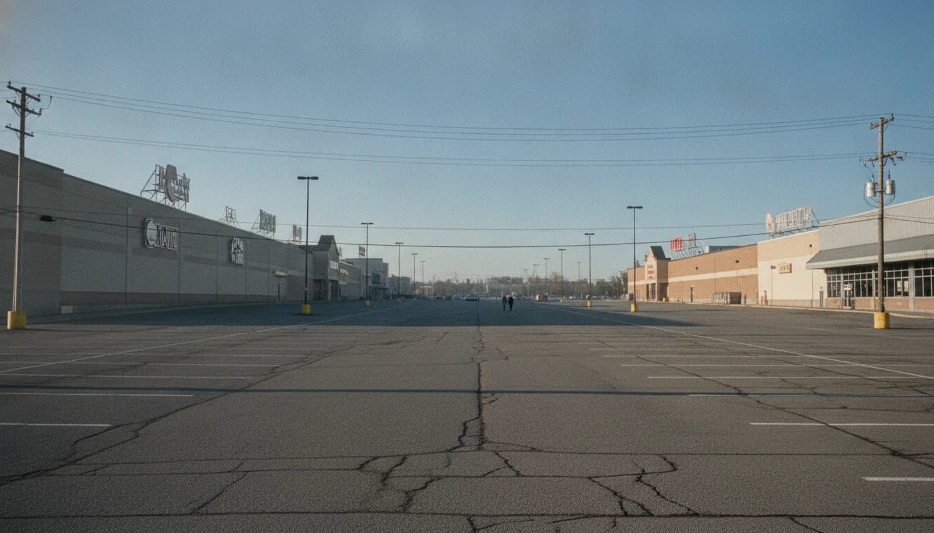
Montreal’s east end is moving toward a major redevelopment anchored by the future Blue Line station at Langelier. On April 7, 2025, the Saint-Léonard arrondissement officially deposited the Plan directeur d’aménagement et de développement (PDAD) for the Langelier sector, signaling a coordinated vision to transform 35 hectares of land east of the Langelier Boulevard into a connected, walkable, and environmentally resilient district. This plan, developed in collaboration with the City of Montreal and the Saint-Léonard arrondissement, lays out the spatial, housing, and mobility framework intended to guide both public investments and private development as Montreal’s transit network expands. The deposition date and the plan’s framing are documented in city proceedings from the April 7, 2025 council meeting. According to these records, the PDAD for Langelier is designed to steer the transformation around what will be one of the system’s key new nodes—the Madeleine-Parent station on the Blue Line, with service anticipated in 2031. The PDAD is the blueprint for a neighborhood that aims to balance housing, commerce, green space, and mobility around a rapid-transit core. (Primary source: City of Montreal deposition docket; official PDAD document) (ville.montreal.qc.ca)
In the months that followed, the City of Montreal publicly framed the PDAD as a long-term investment in a complete, walkable, and climate-resilient district. A subsequent city article highlighted that the plan envisions a neighborhood designed to be accessible without a car, featuring green infrastructure and a layout that prioritizes active transportation. The article reiterates the plan’s aim to align with broader municipal and borough policies and to harmonize with the forthcoming Blue Line transit corridor. The PDAD is part of a larger strategy to guide the district’s evolution in tandem with transit and housing needs, with the normative expectation of shaping development decisions for years to come. (Primary source: City news release) (montreal.ca)
The story of the Langelier PDAD plan is also being watched beyond city halls. A May 5, 2025 report from TVA Nouvelles ties the PDAD to a broader, high-profile development push around the Blue Line corridor, noting Groupe Mach’s involvement in projects near the Langelier station and the legislative tools the province has enabled to accelerate residential towers near transit. The article situates the Langelier plan within a larger provincial context of easing zoning barriers to support transit-oriented development. It also quotes urbanists who critique some regulatory concessions, underscoring that different stakeholders view the PDAD’s potential benefits and risks in a nuanced way. (Primary source: TVA Nouvelles) (tvanouvelles.ca)
Anchor to a real, dated event: The deposition of the PDAD project for Langelier took place on April 7, 2025, during the Saint-Léonard arrondissement’s council session. The council’s decision note explicitly states the objective to “Dépôt du projet de Plan directeur d’aménagement et de développement du secteur Langelier,” and the accompanying records confirm the date and the action. This is the precise, citable event around which the subsequent reporting and analysis are anchored. (Primary source: City of Montreal council minutes, April 7, 2025) (ville.montreal.qc.ca)
Section 1: What Happened
PDAD Deposition and Adoption
The pivotal event began with the formal deposition of the Langelier PDAD on April 7, 2025. The city’s official council documentation identifies the agenda item as “Dépôt du projet de Plan directeur d’aménagement et de développement du secteur Langelier,” reflecting a formal moment when the PDAD entered the public decision-making record. The minutes show the plan’s deposition as a key milestone in aligning zoning, infrastructure, and land-use decisions with the anticipated Blue Line extension. This deposition did not exist in a vacuum; it followed a multi-year planning arc that started with public consultations and interdepartmental collaboration aimed at shaping a coherent, long-range vision for Langelier. The deposition date is explicitly recorded in the council’s decision sheet for Saint-Léonard, with the plan’s deposit acknowledged and “acte de dépôt” noted in the event materials. (Primary source: City of Montreal council minutes, April 7, 2025) (ville.montreal.qc.ca)
Immediately surrounding the deposition, the PDAD’s stated purpose became clearer: to guide the transformation of a 35-hectare parcel east of Langelier Boulevard, adjacent to the future Blue Line station, with the station opening slated for 2031. The PDAD defines a long-term strategy for public realm, housing, commercial activity, and mobility (including the shift toward walking, cycling, and transit-proximate living). The deposition text confirms the PDAD’s scope and its alignment with the broader transit project, including the planned station at the intersection of Jean-Talon Est and Langelier. (Primary source: PDAD deposition document; city planning narrative) (ville.montreal.qc.ca)
Timeline of Key Steps
- 2023: The planning process begins with public engagement and a joint planning effort between the City of Montreal’s urbanism and mobility services and the Saint-Léonard arrondissement. The PDAD concept is shaped to reflect community needs and to set a framework for future development around transit-oriented opportunities. (Primary source: PDAD planning narrative; deposition context) (ville.montreal.qc.ca)
- 2024: The City’s planning framework includes broader urban planning strategies and references the PDAD as a local sectoral development tool. The PDAD’s relationship to the city’s urbanism suite is documented in planning materials and in the Planning and Mobility 2050 stream. (Primary source: City planning documents) (ville.montreal.qc.ca)
- April 7, 2025: The project deposit is officially recorded, signaling the plan’s entry into the formal process and enabling subsequent regulatory alignment and public consultation phases. (Primary source: City of Montreal council minutes) (ville.montreal.qc.ca)
- May 5, 2025: Media coverage contextualizes the PDAD deposit within broader development activity around the Blue Line’s Langelier corridor, highlighting the potential for high-rise towers and the regulatory tools enabling rapid permitting. (Primary source: TVA Nouvelles) (tvanouvelles.ca)
- October 23, 2025: The City of Montreal publishes a public-facing update noting that the PDAD for the Langelier sector has been adopted, signaling the plan’s deeper integration into regulatory practice and project-level decision-making. (Primary source: City of Montreal official update) (montreal.ca)
Core Provisions of the PDAD
The PDAD is designed to provide a holistic framework for the Langelier sector, balancing housing, commerce, open space, and mobility. The plan’s content emphasizes four guiding orientations, a concept of urban design that aligns with climate resilience, and a strategy for implementing the vision over time. The deposition document describes a transformation that centers on a pedestrian-friendly network, a central park spine, and a mix of uses that enable a vibrant mixed-use district around a transit node. It also outlines a regulatory approach, including the use of an “Plan d’aménagement d’ensemble” (PAE) as a tool to articulate the spatial structure, amenities, and density targets envisioned for the area. (Primary source: PDAD deposition document) (ville.montreal.qc.ca)
Section 2: Why It Matters
Housing Stock and Density Implications
The PDAD lays out a housing target that, when coupled with the sector’s 35-hectare footprint, implies a significant density shift for the Langelier area. The plan specifies 6,000 to 8,000 new housing units within the 35-hectare sector. If one applies a straightforward units-per-hectare calculation, that translates to roughly 171 to 229 units per hectare on average, depending on the final mix of housing types and the portion of land dedicated to non-residential uses. This density range places Langelier among Montreal’s higher-density transit-oriented corridors, reinforcing the Blue Line as a central mobility spine around which housing growth can be more efficiently supported. While the PDAD document provides the unit target and area, the actual realized density will depend on regulatory decisions, market conditions, and the phasing of infrastructure investments. (Primary source: PDAD deposition document) (ville.montreal.qc.ca)
The proportionality between 6,000–8,000 units and 35 hectares is not simply a statistic; it is a signal about the kind of neighborhood the PDAD intends to stage—a district with a commanding residential base, designed to attract a broad demographic, including families, professionals, and smaller households that can thrive in a car-light, transit-oriented environment. The PDAD also signals that a large share of the growth is planned around housing, open space, and community facilities, rather than solely large-scale commercial development. The emphasis on balanced uses is visible in the PDAD’s described plan for green spaces, public spaces, and community facilities. (Primary source: PDAD deposition document) (ville.montreal.qc.ca)
In the public-facing materials summarizing the plan, the City of Montreal underscores the intention to create a complete neighborhood with a walkable core and a robust network of active transportation options. The PDAD’s framework includes a central park axis, a network of green spaces, and spaces allocated for collective amenities. The goal is to encourage residents to choose walking, cycling, and transit as primary modes of mobility, in alignment with Montreal’s broader climate and mobility objectives. (Primary source: City planning article) (montreal.ca)
Transit-Oriented Development and Mobility
The PDAD’s strategic emphasis on mobility is tightly linked to the Blue Line’s extension. The future Madeleine-Parent station (the Langelier corridor’s focal point) is presented as the anchor for a dense, attractively designed neighborhood where transit access is integrated into daily life. The plan explicitly ties the district’s success to the Blue Line service planned for 2031, and the PDAD positions mobility as a catalyst for both housing and commercial growth. The deposition and subsequent public statements reflect a philosophy that emphasizes pedestrian and cyclist mobility, with a broader strategy to reduce reliance on private cars in the district. The station’s role as a mobility hub is echoed across the planning documents and city communications. (Primary source: PDAD deposition; City of Montreal PDAD materials) (ville.montreal.qc.ca)
Urbanists quoted in media coverage have offered a mixed, but important, perspective on the plan’s potential. In TVA Nouvelles coverage, a Montreal-based academic laments the perception that developers seek to “have their cake and eat it too,” critiquing certain regulatory accommodations needed to realize the PDAD’s height and density ambitions. The commentary reflects ongoing tensions between transit-oriented growth ambitions and regulatory discipline, a dynamic common to large-scale urban redevelopment projects. The discussion underscores that PDADs are not merely land-use diagrams; they are political and governance instruments that require careful implementation and ongoing public accountability. (Primary source: TVA Nouvelles) (tvanouvelles.ca)
Environmental and climate considerations also feature prominently in the PDAD’s framing. The PDAD expects to incorporate green infrastructure and biodiverse spaces into the urban fabric, using parking lot redesigns, permeable surfaces, and integrated stormwater management to reduce the district’s ecological footprint. The plan’s emphasis on green corridors and parks is aligned with Montreal’s climate objectives and Saint-Léonard’s municipal strategies, which call for resilience through nature-based solutions and strategic open space planning. While the specifics of these green strategies are embedded in the PDAD’s text, the public-facing materials emphasize a park-centric spine and a network of smaller green spaces to knit the district together. (Primary source: PDAD deposition; City planning materials) (ville.montreal.qc.ca)
Section 3: What’s Next
Regulatory Alignment and Zoning Changes
With the PDAD deposited and ultimately adopted, the next phase involves translating the broad vision into concrete zoning and regulatory updates. The PDAD’s implementation hinges on a regulatory framework that can accommodate higher densities, mixed uses, and mobility-oriented urban form, while ensuring compatibility with existing zoning and urban-design guidelines. The PDAD introduces the concept of an “ensemble planning framework” (Plan d’aménagement d’ensemble) to guide the transformation of large tracts, including the Langelier corridor’s major redevelopment parcels. This approach requires coordinated action between the City’s SUM (Urbanism and Mobility), the Saint-Léonard arrondissement, and adjacent boroughs, along with input from developers and community groups. In practical terms, the city will need to adjust zoning overlays, develop a phasing plan, and set performance metrics for green space, parks, and public facilities as development proceeds. (Primary source: PDAD deposition; city planning materials) (ville.montreal.qc.ca)
The deposition and subsequent adoption set the stage for public engagement and regulatory adoption. Montreal’s planning framework includes a sequence of public consultations, technical reviews, and council votes to grant the PDAD regulatory authority and to guide the approval processes for major projects within the sector. The April deposition acts as a formal trigger for these steps, which will be essential for coordinating with the Blue Line’s construction timeline, including track and station works and the integration of transit-supportive amenities. (Primary source: City council minutes; PDAD deposition) (ville.montreal.qc.ca)
Public Engagement and Next Milestones
Public participation remains a core component of the PDAD’s synthesis and implementation. The city and arrondissement have signaled ongoing opportunities for residents to engage in the shaping of the Langelier district, with the PDAD acting as the policy instrument that channels community input into design decisions, open-space allocations, and mobility solutions. The PDAD’s public engagement plan is designed to foster transparency and ensure that the neighborhood’s growth aligns with residents’ expectations for housing affordability, green space, and accessibility. The official city communications emphasize that the PDAD’s implementation will unfold in stages, with opportunities for feedback as development proposals move from concept to detailed design and permitting. (Primary source: City planning materials; PDAD narrative) (montreal.ca)
What to watch for next includes regulatory updates, potential development announcements, and the timing of public consultations tied to zoning amendments. The PDAD’s articulation of Plan d’aménagement d’ensemble (PAE) in particular will be a focal point for developers and for municipal staff, as the PAE will guide large-scale intervention across the sector. The City’s ongoing communications and forthcoming council decisions will provide important signals about the pace and direction of Langelier’s transformation as the Blue Line project moves toward its 2031 opening target. (Primary source: PDAD deposition; City planning materials) (ville.montreal.qc.ca)
Closing
The Langelier PDAD plan marks a watershed moment for Montreal’s east side, turning a transit opportunity into a concrete development program. With the April 7, 2025 deposition now in the record and adoption moving forward, Montreal is attempting to harmonize rapid transit expansion with a long-range neighborhood built to accommodate thousands of new residents and a mix of commercial and cultural activities. The PDAD’s emphasis on walkability, green space, and a transit-oriented mobility network reflects a broader shift in urban planning toward sustainable, people-focused urbanism. As ongoing public engagement unfolds and zoning changes take shape, observers will be watching not only the finished built form but also how well the Langelier PDAD plan translates into a livable, affordable, and resilient community around the Blue Line’s future Madeleine-Parent station. For residents and readers of Montréal Times, the PDAD’s next milestones—public hearings, zoning amendments, and development approvals—will determine whether the sector’s ambitious vision becomes a tangible, well-integrated neighborhood by 2031 and beyond.
If you’d like to stay updated on the Langelier PDAD plan, monitor City of Montreal communications and Saint-Léonard arrondissement updates for new notices, as well as reputable local outlets reporting on the Blue Line corridor. The plan’s deposition and subsequent adoption are anchored in formal documents accessible through city records, providing a transparent basis for the district’s long-range transformation. (Primary sources: City of Montreal deposition dossier; Montreal city update article) (ville.montreal.qc.ca)