ÎLe-aux-Tourtes Bridge Reconstruction Progresses

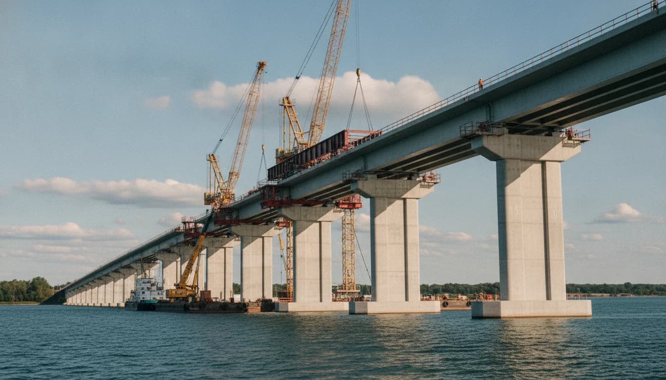
The Montréal Times brings you a data-driven update on the Île-aux-Tourtes bridge reconstruction, a project central to regional mobility and cross-river connectivity. As Quebec’s Transport Ministry continues to maintain and rebuild the bridge, officials stress a careful balance between keeping traffic flowing and delivering a modern, safer structure. The latest public-facing information confirms that work is progressing in multiple sites along the corridor, with a staged opening plan designed to minimize disruption while expanding capacity and multimodal options. Partial service is planned for December 2026 on the reconstruction, according to the Government of Quebec's project dashboard, marking a significant milestone in the long-running effort to update this vital link. (quebec.ca)
For readers of the Montréal Times who rely on stable, data-backed reporting, the key takeaway is that the Île-aux-Tourtes bridge reconstruction is moving from planning to phased execution, with a clear schedule that aims to translate into tangible traffic relief and safer travel conditions over the next few years. The project’s scale—three lanes per direction, a new shared-use path, and widened shoulders designed for exclusive use by buses during peak periods—reflects a modernization effort that has been in the works for several years and involves substantial coordination with regional transit and environmental oversight. As the first sections near completion, transportation planners are watching traffic patterns, preservation of ecological habitats, and the integration of potential rail or bus rapid transit opportunities within the corridor. (quebec.ca)
Opening paragraph: The news now is precise and consequential—the Île-aux-Tourtes bridge reconstruction is entering a multi-phase construction window that could alter how thousands move between Île de Montréal, Vaudreuil-Dorion, and surrounding communities. The project’s current plan envisions the opening of a northern new structure by late 2026, followed by a second structure in 2027, with the current bridge to be demolished in phases through 2029 and final site work concluding in 2030. The project budget stands at roughly 2.3 billion dollars, fully funded by the Government of Quebec. These milestones matter for commuter timing, goods movement, and regional development strategies, and they frame ongoing discussions about transportation resilience in the greater Montréal region. (quebec.ca)
What Happened
Project scope and design features
The Île-aux-Tourtes bridge reconstruction is a major upgrade of a critical cross-river connector along Autoroute 40. The new configuration will include three lanes of traffic per direction, a bi-directional multi-use path, and widened shoulders to accommodate a dedicated use by buses during peak periods (UAB). This combination aims to improve safety, mobility, and access for active transportation across the corridor, aligning with broader Quebec goals around transit integration and climate-conscious infrastructure. The scale and specifics of the plan are outlined in the Ministry of Transport and Mobility’s project documentation. (quebec.ca)
Timeline and sequence of construction
Work began in earnest in autumn 2023, and public information indicates a staged schedule designed to deliver usable capacity before the full deconstruction of the existing structure. The first new structure is targeted to be in service by the end of 2026, with a five-lane flow managed dynamically to meet peak-period demands. A second new structure is expected to open in 2027, bringing the total across the corridor to three lanes per direction on a constant basis. The current bridge is slated for partial or complete deconstruction in later phases, with final project completion anticipated around 2030. The project timeline also notes ongoing construction activities in multiple sub-sites, including the Senneville approach, the Girwood Island shoreline, and the Vaudreuil-Dorion approaches, reflecting a distributed work model designed to accelerate delivery while maintaining roadway access. (quebec.ca)
Navigation channel adjustments and in-water work
A notable operational detail concerns the navigational channel beneath the bridge. Beginning August 24 of the current year, the channel under the Île-aux-Tourtes bridge will be moved toward Vaudreuil-Dorion to support the in-water work that accompanies the reconstruction. This adjustment is part of a broader sequence of channel relocations to accommodate pile driving, foundation work, and the placement of the new bridge structures. The relocation is temporary but essential for maintaining shipping and boating access while construction proceeds. (quebec.ca)
Cost and funding framework
The government has publicly stated a total project cost of approximately 2.3 billion dollars for the reconstruction of the Île-aux-Tourtes bridge, with funding fully provided by the province. That funding supports design, construction, and long-term maintenance considerations across the new corridor, including the multi-use path and bus-ready shoulders that are central to the long-term mobility strategy for the region. Cost estimates and funding details are documented in the ministry’s project materials and dashboard updates. (quebec.ca)
Traffic volumes and operational context
Prior to reconstruction, the existing bridge served about 81,000 vehicles per day, with trucks comprising roughly 11% of that traffic. These baseline figures help planners gauge the expected demand that the new structure must accommodate, particularly as the corridor pursues higher-capacity operations and smoother congestion management. The traffic metrics are reported within the project’s ongoing oversight materials and public-facing updates. (quebec.ca)
Background and governance context
The Île-aux-Tourtes reconstruction is a public-infrastructure project managed under Quebec’s major infrastructure framework, with oversight and verification delivered through the BAPE process and the MTQ project dashboards. In parallel, the project has included public information sessions, environmental assessments, and consultations designed to align the new bridge with regional planning and environmental safeguards. This governance approach helps ensure that the reconstruction remains transparent and accountable through all phases of development. (bape.gouv.qc.ca)
Public communications and community updates
Public communications emphasize sustained information access for residents and commuters. Municipal and provincial channels provide regular updates, including the project’s official social media feeds, dedicated pages on the Gouvernement du Québec site, and local municipal notices. The public-facing materials describe expected traffic patterns, detours, and mitigation measures designed to reduce the impact of construction on daily travel. For example, Senneville and surrounding communities have issued notices and updates describing temporary traffic configurations and detour routes as the work progresses. (senneville.ca)
Section 1 takeaway: what happened and why it matters now
Taken together, the Île-aux-Tourtes bridge reconstruction represents a substantial modernization of a key regional artery, with a defined phased deployment that promises earlier relief in peak travel times and improved long-term resilience. The project’s design emphasizes a balanced approach that increases capacity while preserving mobility for freight and commuters, and it is backed by a formal budget and governance mechanism designed to track progress and adjust plans as needed. The core facts—the phased openings, the three lanes per direction, the multi-use path, and the in-water work—are grounded in official project materials and dashboards. (quebec.ca)
Why It Matters
Mobility and regional economic impact
The Île-aux-Tourtes bridge is an essential cross-river connector for the Montréal metropolitan region. By adding three lanes per direction and a dedicated multi-use path, the reconstruction aims to reduce bottlenecks and offer more reliable travel times for both people and goods. The project aligns with broader regional objectives to enhance multimodal connectivity, promote transit-oriented development, and support economic activity in Vaudreuil-Dorion, Senneville, Sainte-Anne-de-Bellevue, and other communities connected via Autoroute 40. The official project materials highlight mobility, safety, and integration with transit as central objectives. (quebec.ca)
Multimodal integration and future transit opportunities
In addition to vehicle lanes, the project explicitly contemplates a future where the corridor could host enhanced public transit options. The environmental and architectural planning documents discuss the potential for a rail-based transit corridor within the larger A-40 alignment, signaling a long-range intent to connect the bridge reconstruction with regional rail or bus rapid transit plans. While specific timelines for such transit improvements are not fixed in this update, the governance documents emphasize a corridor approach that preserves options for future mobility solutions. (bape.gouv.qc.ca)
Environmental and community considerations
Environmental assessments associated with the project underscore a commitment to minimizing ecological disruption during construction, with mitigation strategies designed to protect aquatic habitats and shorelines. The environmental evaluation and public consultation records provide a framework for ongoing monitoring and adaptive management as construction proceeds. Community communications emphasize staying informed and participating in the planning process to ensure that local concerns are addressed as work unfolds. (environnement.gouv.qc.ca)
Public safety and network resilience
Public safety is a recurring theme in the Île-aux-Tourtes reconstruction narrative. The new bridge configuration includes improved safety features, modernized structural components, and better integration with active transportation modes. The expanded width and revised curb configurations are paired with dedicated bus accommodations in areas where traffic management allows, supporting safer travel for all road users. The project’s official materials frame safety and reliability as core outcomes of the reconstruction. (quebec.ca)
Section 2 takeaway: what the broader implications look like
For readers and stakeholders, the Île-aux-Tourtes bridge reconstruction signals a significant upgrade to a linchpin regional corridor. The project’s phased approach is designed to deliver early milestones (partial service by late 2026) while laying the groundwork for sustained capacity improvements through 2027 and beyond. The broader implication is a more resilient transportation network that can better accommodate growth in both commuter and freight traffic, potentially reducing delays and improving cross-river connectivity for the long term. (quebec.ca)
What's Next
Next milestones and monitoring
Looking ahead, the project’s next major milestones include the opening of the second new structure in 2027, followed by continued dismantling and finalization work on the existing structure through 2030. In the near term, observers should monitor updates on traffic management changes, the progress of water-work components, and any adjustments to the opening schedule as a result of on-site conditions or regulatory reviews. The official dashboards and public notices will continue to provide updated timelines and sector-by-sector progress. (quebec.ca)
Next steps for residents and commuters
Residents and commuters should prepare for staged traffic configurations and temporary detours as the work progresses. The project materials recommend consulting Québec 511 and local communications from Senneville and nearby municipalities to plan routes and anticipate changes during peak periods. Public transit planning is also likely to adapt to the evolving road conditions, with the potential for increased bus service or rail options being discussed in parallel with the corridor’s modernization. (quebec.ca)
What to watch for in the near term
- Early openings of the first new structure by late 2026 and the effect on peak-hour travel times. The project’s staged opening approach distributes traffic more evenly across the corridor as new capacity becomes available. (quebec.ca)
- In-water construction milestones, including channel relocation and foundation work, which will influence boating activity and waterway access in Lac des Deux Montagnes and the Baie de Vaudreuil. These operations are critical for enabling the new bridge foundations and align with environmental safeguards. (quebec.ca)
- Ongoing public communications and consultations to address community concerns and to share updates on detours, transit adjustments, and safety measures. The province and local municipalities maintain channels for staying informed and providing feedback. (quebec.ca)
Closing
The Île-aux-Tourtes bridge reconstruction represents a major inflection point for regional mobility in the Montréal area. By delivering a new bridge structure with three lanes per direction, a dedicated multi-use path, and bus-friendly shoulders, Quebec aims to boost capacity, enhance safety, and support multimodal travel for years to come. The staged opening plan—first structure by the end of 2026, second structure by 2027, and a multi-year deconstruction and finalization timeline through 2030—offers a clear roadmap for readers watching traffic patterns and infrastructure modernization unfold along Autoroute 40. As always, staying informed through provincial dashboards and municipal notices will help residents best plan around construction activity and leverage new transit options as they come online. (quebec.ca)
In the weeks and months ahead, the Montréal Times will continue to monitor the progress of the Île-aux-Tourtes bridge reconstruction, providing data-driven updates on traffic volumes, construction milestones, and the broader implications for regional transport and market trends. For readers seeking ongoing, neutral coverage grounded in official sources, we will keep aggregating updates from the ministère des Transports et de la Mobilité durable, the Secrétariat du Conseil du trésor, and local municipalities to ensure a comprehensive view of how this critical corridor evolves. (quebec.ca)